


Zoom Earth

 |
Latest Version | 3.1 |
 |
Update | Jan,04/2025 |
 |
Developer | Neave Interactive |
 |
OS | Android 8.0+ |
 |
Category | Weather |
 |
Size | 28.5 MB |
 |
Google PlayStore |  |
| Tags: | Weather |
-
Latest Version
3.1
-
Update
Jan,04/2025
-
Developer
Neave Interactive
-
OS
Android 8.0+
-
Category
Weather
-
Size
28.5 MB
-
Google PlayStore


 Download(3.1)
Track hurricanes, typhoons, and tropical cyclones in real time with Zoom Earth, an interactive global weather map and hurricane tracker. This powerful tool provides real-time data and visualizations, including satellite imagery, rain radar, and comprehensive weather forecast maps.
[Key Features]
- Satellite Imagery: Access near real-time satellite imagery from NOAA GOES, JMA Himawari, EUMETSAT Meteosat, and NASA's Aqua and Terra polar-orbiting satellites.
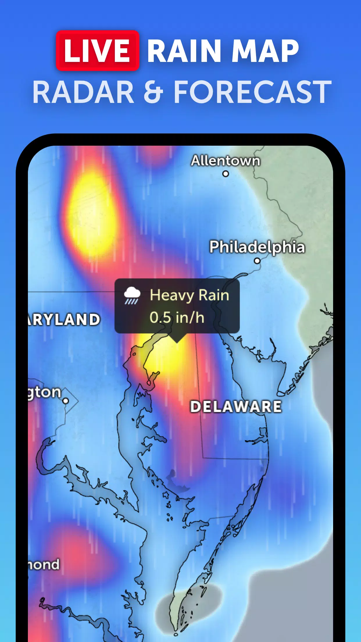
- Rain Radar: Monitor rain and snow with our real-time weather radar map utilizing ground-based Doppler radar data.
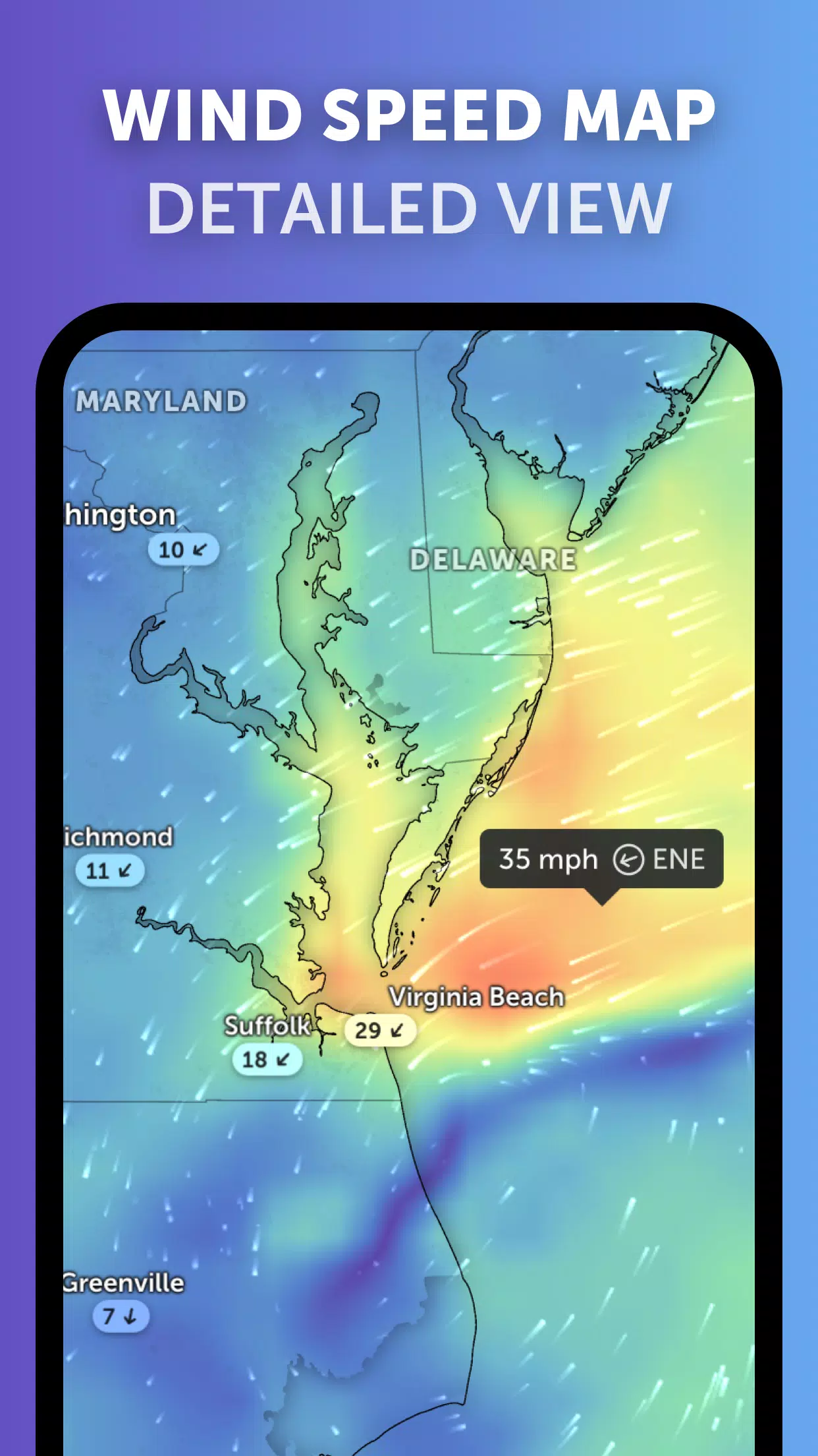
- Weather Forecast Maps: Explore interactive visualizations of global weather forecasts, including precipitation, wind speed and gusts, temperature, "feels like" temperature, relative humidity, dew point, and atmospheric pressure.
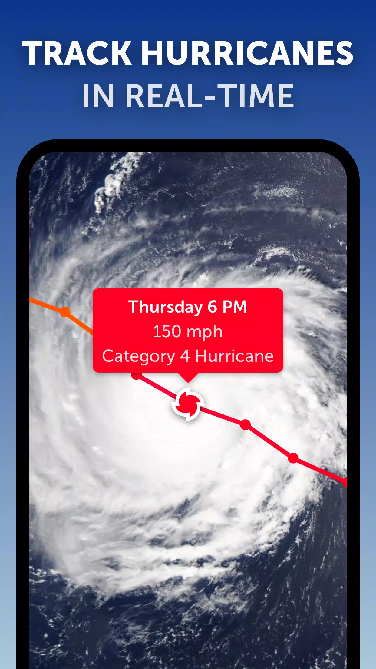
- Hurricane Tracking: Track hurricanes from formation to category 5 intensity using the latest data from NHC, JTWC, NRL, and IBTrACS.
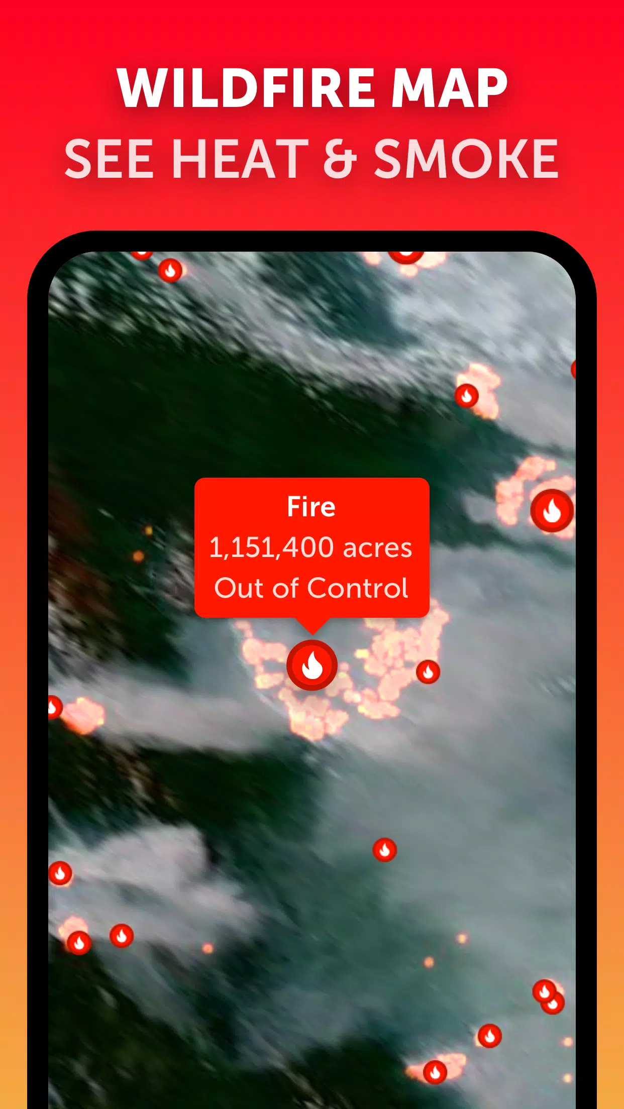
- Wildfire Tracking: Monitor active wildfires and heat spots using daily updates from NASA FIRMS, showing areas of high temperature detected by satellite.
- Customization: Personalize your experience by adjusting temperature and wind units, time zone, animation styles, and more.
What's New in Version 3.1 (Last updated September 19, 2024)
- Reduced visual clutter when viewing multiple tropical weather systems.
- Separate alerts for Atlantic and Eastern Pacific systems.
- Improved map labels.
Post Comments
Your Comment(*)