


Land Parcels Areas Calculator

 |
Latest Version | 3.2.3 |
 |
Update | Aug,17/2025 |
 |
Developer | GeoZidan |
 |
OS | Android 5.1 or later |
 |
Category | Tools |
 |
Size | 3.83M |
| Tags: | Tools |
-
Latest Version
3.2.3
-
Update
Aug,17/2025
-
Developer
GeoZidan
-
OS
Android 5.1 or later
-
Category
Tools
-
Size
3.83M


 Download(3.2.3)
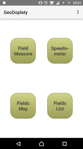
The Land Parcels Areas Calculator is a free tool crafted for farmers, offering a suite of GPS-based features. This app enables precise measurement of crop and farmland areas, leveraging advanced GPS technology for accurate results. It also includes a speedometer to monitor fieldwork at consistent speeds. Farmers can save measurements, export data, and organize surveys effortlessly. With its intuitive design and practical tools, this app is essential for optimizing farm tasks and securing EU direct payments.
Features of Land Parcels Areas Calculator:
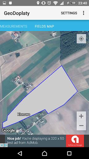
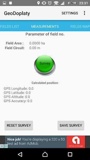
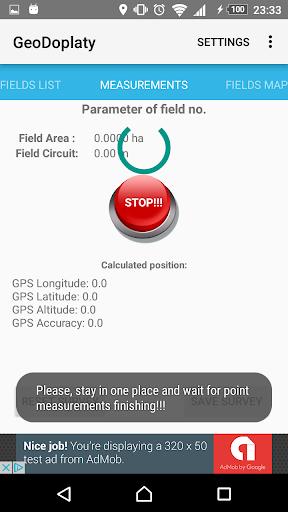
⭐️ Accurate parcel area measurement: Use GPS technology to precisely calculate the area of your farmland or crops.
⭐️ Advanced GPS positioning algorithm: A unique algorithm ensures highly accurate GPS data for dependable measurements.
⭐️ Parcel circumference measurement: Measure the perimeter of agricultural plots alongside area, providing complete farm data.
⭐️ Save and export data: Record measurements in the app and export them as shapefiles for analysis or sharing.
⭐️ Streamlined survey management: Organize and access survey data with ease for quick reference and efficient planning.
⭐️ Fieldwork speedometer: Boost efficiency with a built-in speedometer, set a target speed, and get alerts if exceeded.
Conclusion:
The Land Parcels Areas Calculator is a robust, easy-to-use app delivering precise area and circumference measurements, seamless data recording and exporting, efficient survey tools, and a speedometer for enhanced fieldwork productivity. Download today to optimize farming and apply for EU direct payments.