


スーパー地形 - GPS対応地形図アプリ
 |
Latest Version | 4.6.17 |
 |
Update | Dec,04/2024 |
 |
Developer | kashmir3d |
 |
OS | Android 5.0+ |
 |
Category | Maps & Navigation |
 |
Size | 16.7 MB |
 |
Google PlayStore |  |
| Tags: | Maps & Navigation |
-
Latest Version
4.6.17
-
Update
Dec,04/2024
-
Developer
kashmir3d
-
OS
Android 5.0+
-
Category
Maps & Navigation
-
Size
16.7 MB
-
Google PlayStore


 Download(4.6.17)
Super Terrain: A Comprehensive Guide to its Powerful Mapping Features
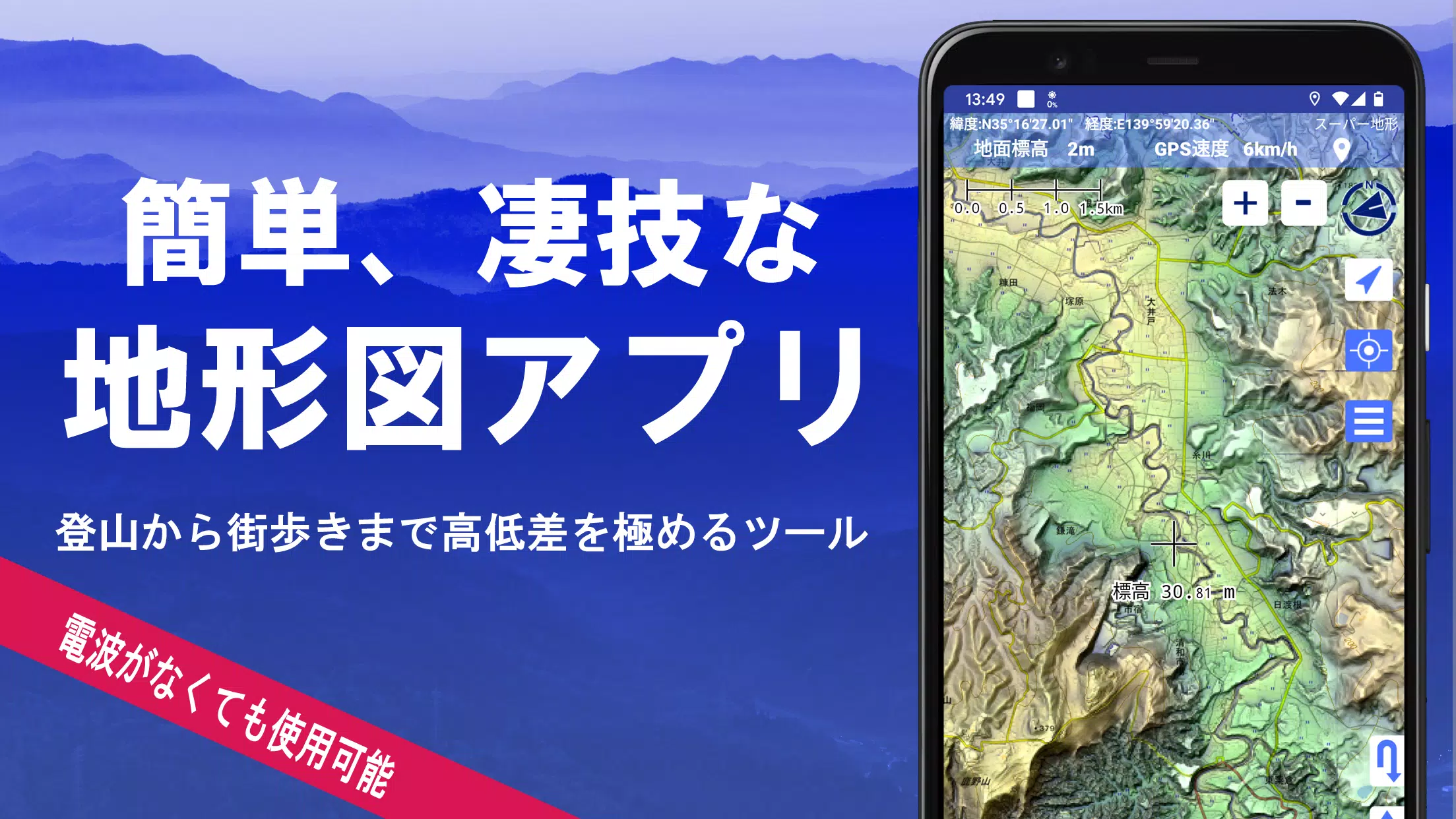
Super Terrain boasts over 100 map types, including those from the Geospatial Information Authority of Japan (GSI), offering unparalleled detail for various activities from urban exploration to mountaineering. A recipient of the 2018 Japan Cartographic Society Award, this app utilizes unique technology to create highly detailed "super terrain data," maximizing elevation differences for precise visualization.
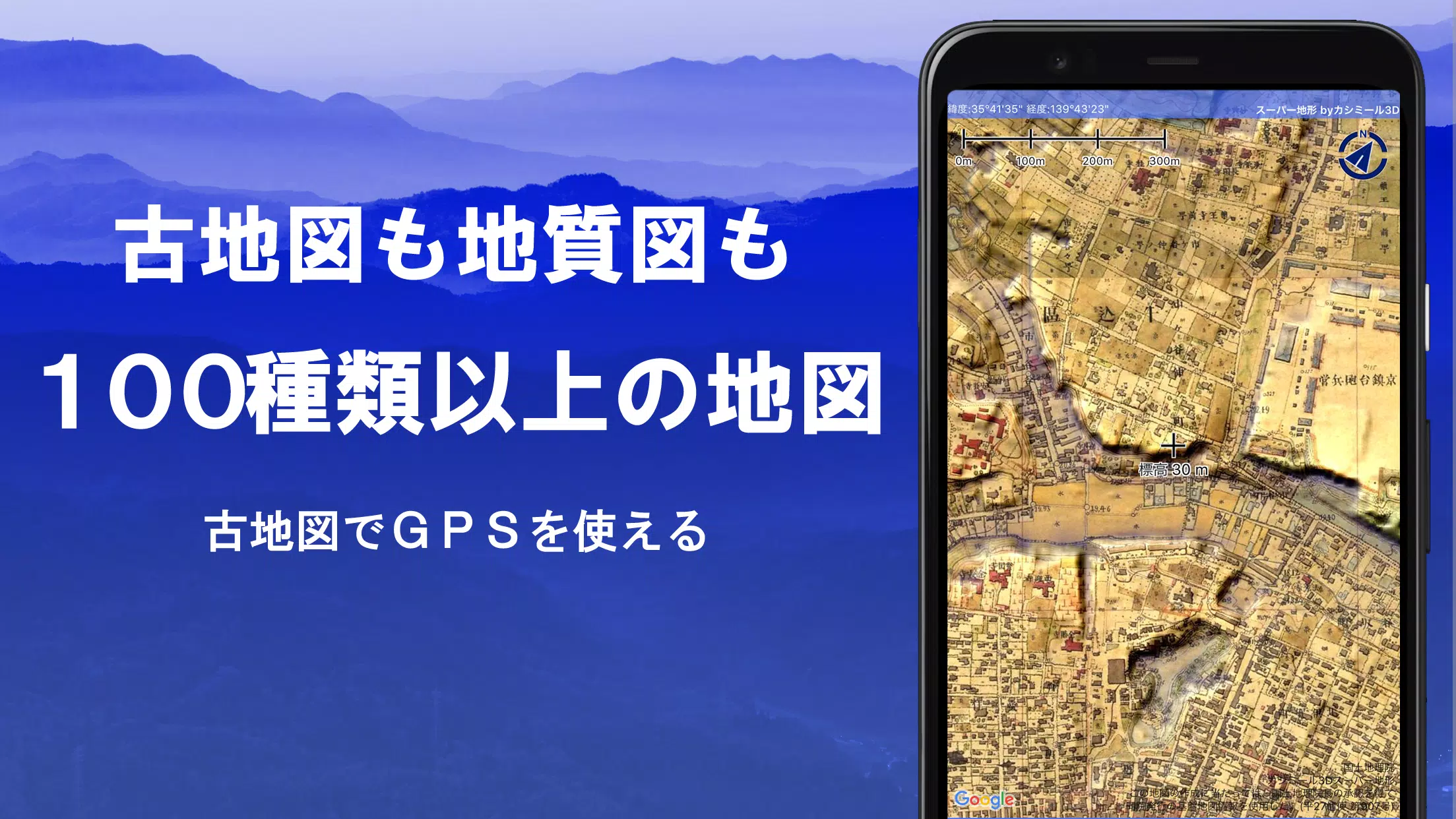
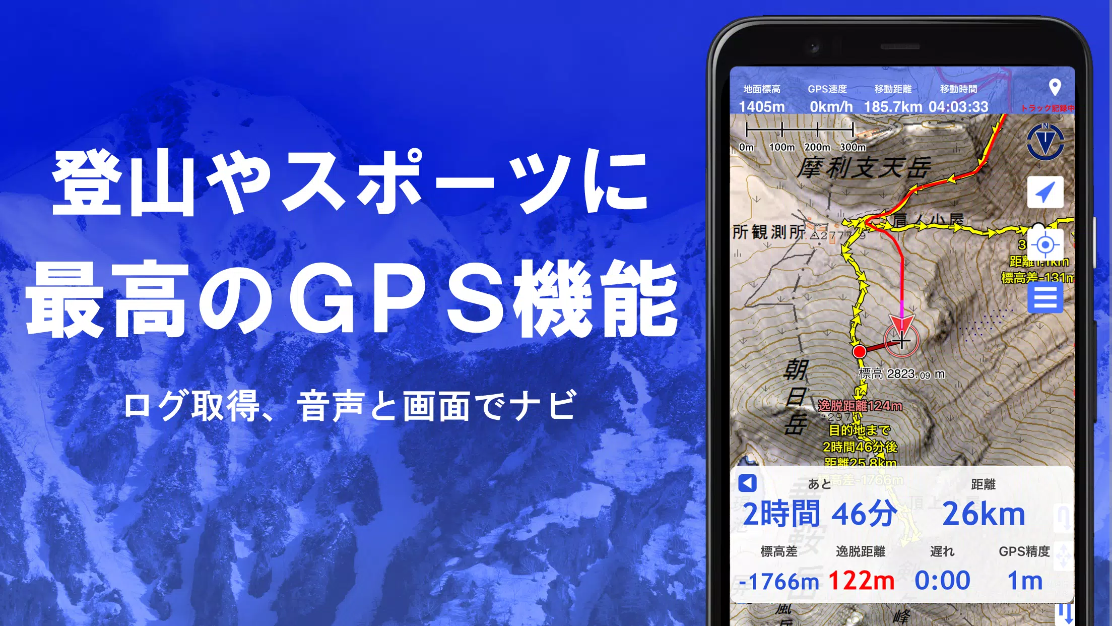
The app's extensive map library includes GSI geographical survey maps, topographic maps, geological maps, historical maps, and even pre-war topographic maps. GPS functionality allows for track recording (trajectory) with GPX import/export and editing capabilities. Features tailored for hiking, mountaineering, and outdoor pursuits include GPS navigation (with audio), data recording, and editing.
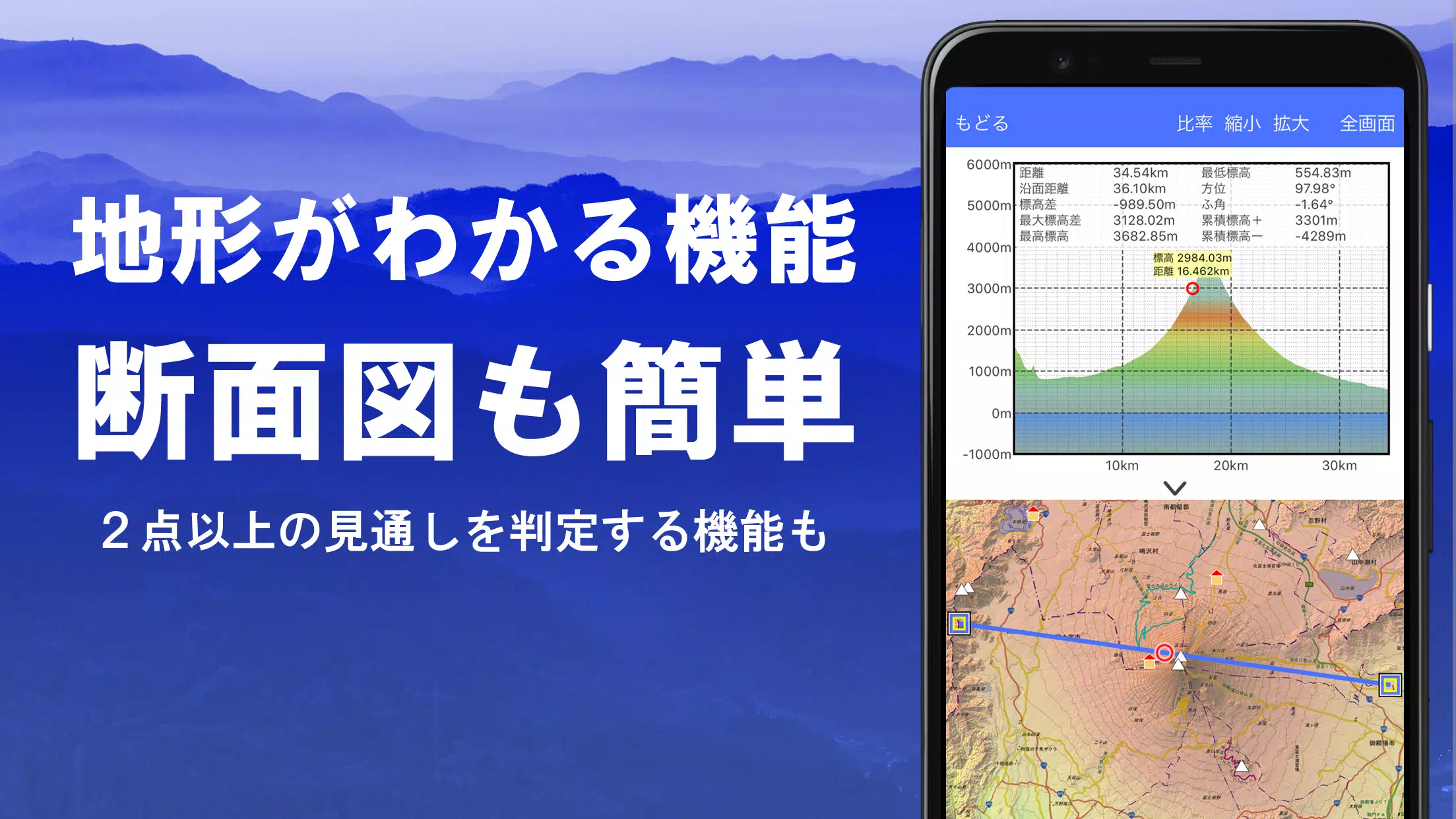
Super Terrain facilitates advanced analysis with its visibility determination function, useful for creating cross-sections, planning observations, and assessing radio signal range. Building data integration enhances cross-sectional views. A 360° panoramic view function, including mountain identification, sun, moon, and GPS point display, adds another layer of functionality.
Offline capabilities are ensured through GPS functionality, bulk map downloads, and map caching, ideal for areas with limited or no signal. Users can associate photos with specific points, view contour lines generated from elevation data, and display MGRS/UTM grids. GeoJSON file support allows for GIS data reading, display, and editing, along with shape drawing capabilities.
Further features include:
- Extensive Map Library: Access over 100 map types, including super terrain data (5-day free trial), GSI maps, and hazard maps. Aerial photograph availability varies by age group.
- Cross-Section & Visibility Analysis: Easily create cross-sections and utilize the visibility judgment function, considering Earth's curvature and atmospheric conditions. Building data integration is also available.
- Elevation Palette: Customize map background colors with a 1cm increment elevation palette.
- Panoramic Views: Enjoy 360° panoramic views with mountain identification, sun, moon, and GPS point displays. Overseas panoramic views are also supported.
- Robust GPS Functionality: High-precision GPS tracking, track recording with detailed parameters (elevation change, speed, time), point alarms, photo association, and NaviCon integration.
- GPS Track Playback: Review recorded tracks with automatic photo matching based on timestamps.
- GPS Navigation: Navigate using pre-set tracks (Track Navi) with voice and alarm alerts for deviations. Route and point navigation are also available.
- GPS Data Editing: Manage GPS points, routes, and tracks within a user-friendly tree structure. GPX import/export is supported.
- Offline Map Usage: Bulk download and caching functions ensure map access even without a signal.
- Map History & Custom Map Support: Access previously viewed locations and import custom maps created with Kashmir 3D's map cutter.
- GeoJSON Compatibility: Display, edit, and create shapes from GeoJSON files.
- Printing & PDF Output: Print or export map areas as PDFs.
- Data Exchange: Import and export data in GPX, KML, and GDB formats.
- Backup & Restore: Back up and restore app data (excluding cached maps) using Google Drive.
- In-App Purchases: Some features (super terrain data, GPS tracks, cross-sections) require in-app purchases (¥780/year, 5-day free trial).
Disclaimer: The developers assume no responsibility for any outcomes resulting from app usage. Continuous GPS use may drain the battery. Refer to the provided PDF for navigation instructions (https://www.kashmir3d.com/online/superdemapp/superdem_navi.pdf). Note that some smartphones may experience track recording interruptions due to power-saving functions.