


AlpineQuest Explorer Lite

 |
Latest Version | 2.3.8d |
 |
Update | Jan,14/2025 |
 |
Developer | Psyberia |
 |
OS | Android 2.1+ |
 |
Category | Travel & Local |
 |
Size | 8.0 MB |
 |
Google PlayStore |  |
| Tags: | Travel & Local |
-
Latest Version
2.3.8d
-
Update
Jan,14/2025
-
Developer
Psyberia
-
OS
Android 2.1+
-
Category
Travel & Local
-
Size
8.0 MB
-
Google PlayStore


 Download(2.3.8d)
Turn your phone into a powerful offline GPS using topographic maps!
No ads, data sharing, monetization, analytics, or third-party libraries.
AlpineQuest is the ultimate app for all outdoor activities, including hiking, running, trail running, hunting, sailing, geocaching, off-road navigation, and more.
Access and store a vast array of online topographic maps for offline use, even without cell service. AlpineQuest also supports numerous onboard raster map formats.
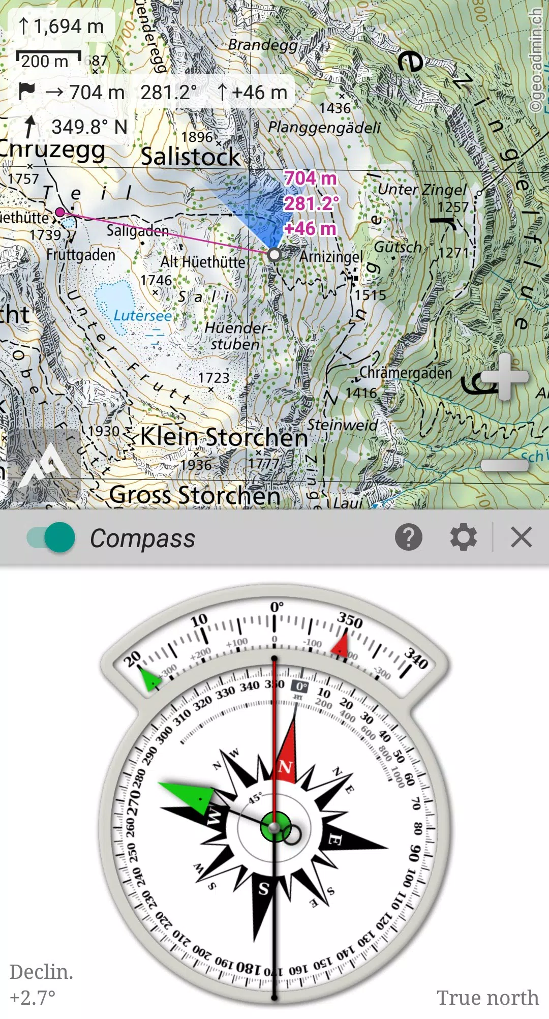
With real-time GPS and compass functionality, getting lost is a thing of the past. Your location is displayed on the map, which can be oriented to match your view.
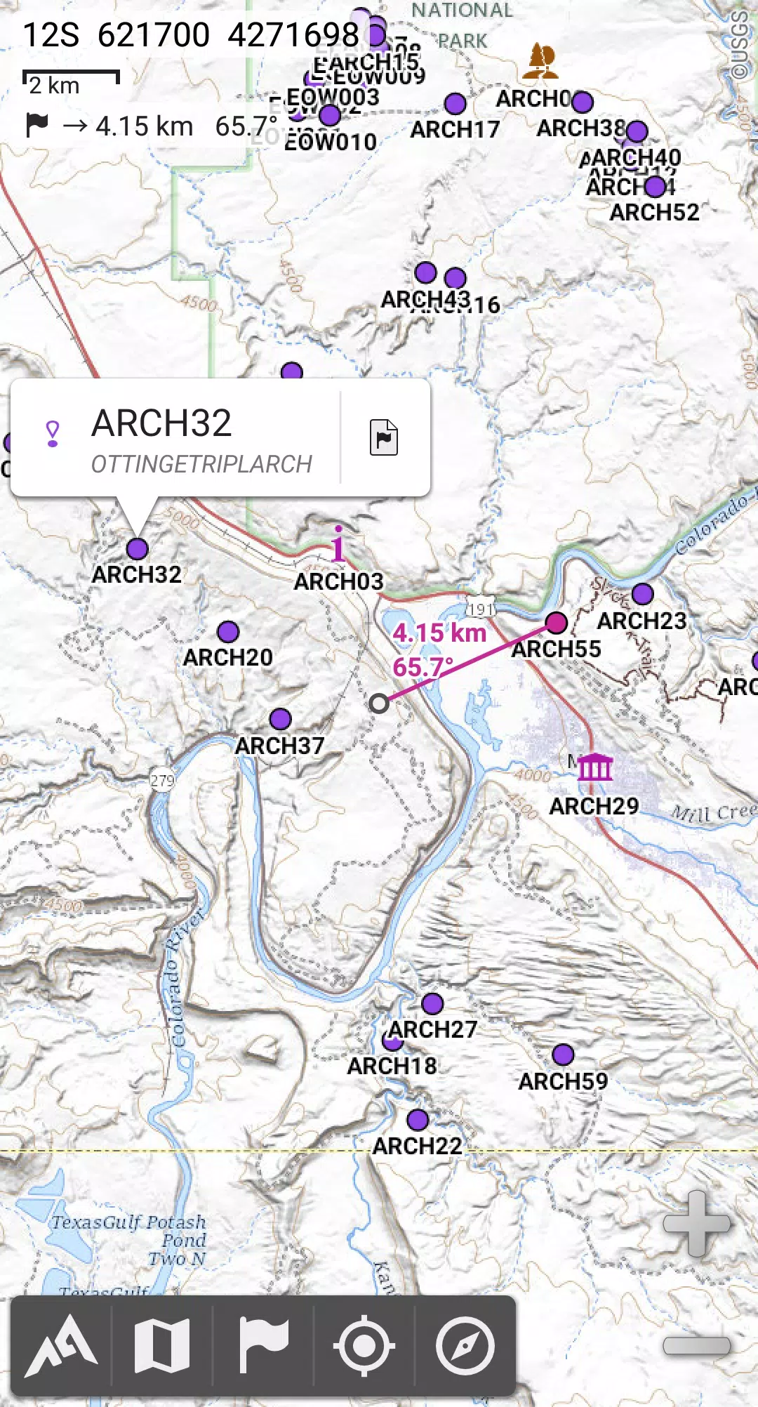
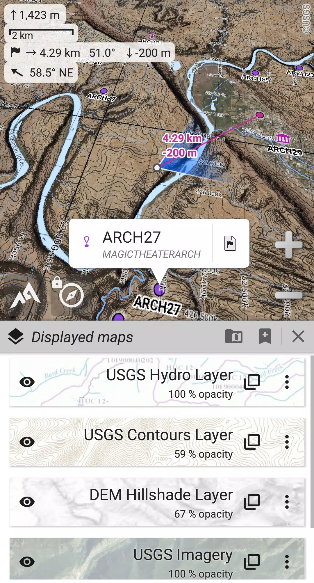
Save and share unlimited waypoints, track your routes, and generate detailed statistics and interactive graphs.
AlpineQuest remains fully functional offline, making it ideal for exploring remote areas.
Download the free Lite version now!
For suggestions or issues, please visit our forum: https://www.alpinequest.net/forum (no registration required, all questions answered). Do not post in the comments section.
Key Features (Full Version):
★★ Mapping ★★
- Integrated online maps (with automatic local storage; road, topo, and satellite maps included) and online layers (road names, hillshade, contours).
- Easily add more online maps and layers from the community maps list (global and local topo maps).
- Complete offline area storage of online maps.
- Onboard offline map support (raster) including KMZ Overlays, OziExplorer OZFx2, OZFx3 (partially), calibrated images, GeoTiff, GeoPackage GeoPkg, MbTile, SqliteDB, and TMS zipped tiles (use MOBAC, the free map creator, available on our website).
- QuickChart Memory Map support (.qct maps only, .qc3 maps are not compatible).
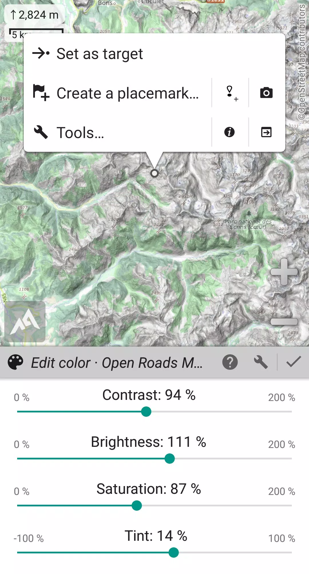
- Built-in image calibration tool for using any scan or picture as a map.
- Digital elevation model (DEM) onboard storage (1-arcsec SRTM DEM) and support for HGT elevation files (1-arcsec and 3-arcsec resolutions) for displaying terrain, hillshade, and steep slopes.
- Polar map support (Arctic and Antarctic).
- Multiple map layers with customizable opacity, contrast, color, tint, and blending.
★★ Waypoints & Tracking ★★
- Create, display, save, and restore an unlimited number of waypoints, routes, areas, and tracks.
- Import/export GPX, Google Earth KML/KMZ, and CSV/TSV files.
- Import ShapeFile SHP/PRJ/DBF, OziExplorer WPT/PLT, GeoJSON, IGC tracks, Geocaching LOC waypoints, and export AutoCAD DXF files.
- Share online locations with others using Community Placemarks.
- Detailed information, advanced statistics, and interactive graphics for various items.
- Time Controller for replaying time-tagged tracks.
★★ GNSS & Orientation ★★
- On-map geolocation using device GNSS receivers (GPS/Glonass/Galileo/…) or network.
- Map orientation, compass, and target finder.
- Built-in GNSS/Barometric track recorder (long tracking capable, runs in a separate lightweight process) with battery level and network strength recording.
- Proximity and leave-path alerts.
- Barometer support (compatible devices).
★★ More Features ★★
- Metric, imperial, nautical, and hybrid distance units.
- Latitude/Longitude and grid coordinate formats (WGS, UTM, MGRS, USNG, OSGB, SK42, Lambert, QTH, …) with on-map grid display.
- Import hundreds of coordinate formats from https://www.spatialreference.org.
- And much more!
What's New in Version 2.3.8d (August 14, 2024)
- New setting to customize menu bar style and position.
- Improved support for recent Android versions.
- Enhanced backup and restore tool.
- New default URL for sharing coordinates as text.
- Option to set the application's "Media" folder as the default for placemarks, icons, pictures, and file-based maps.
- Added Croatian and Persian translations.
- Various improvements and bug fixes.