


2GIS: Offline map & navigation

 |
Latest Version | 6.44.1.559.3 |
 |
Update | Apr,15/2025 |
 |
Developer | 2gis |
 |
OS | Android 6.0+ |
 |
Category | Maps & Navigation |
 |
Size | 180.4 MB |
 |
Google PlayStore |  |
| Tags: | Maps & Navigation |
-
Latest Version
6.44.1.559.3
-
Update
Apr,15/2025
-
Developer
2gis
-
OS
Android 6.0+
-
Category
Maps & Navigation
-
Size
180.4 MB
-
Google PlayStore


 Download(6.44.1.559.3)
2GIS is your ultimate navigation and city exploration tool, offering offline maps, GPS navigation, live traffic updates, parking information, transit routes, and much more. Whether you're driving, walking, or using public transport, 2GIS ensures you never get lost, even without an internet connection, thanks to its downloadable maps.
With 2GIS’s comprehensive maps and navigation features, you can feel at home in any city:
- Easily locate addresses, businesses, phone numbers, operating hours, and find specific goods or services.
- Get detailed directions for driving, taking the bus or subway, or follow pedestrian navigation to reach your destination.
- Find building entrances and nearby parking lots effortlessly.
2GIS boasts highly accurate maps that pinpoint districts, buildings, streets, bus stops, subway stations, gas stations, sports facilities, and numerous other landmarks.
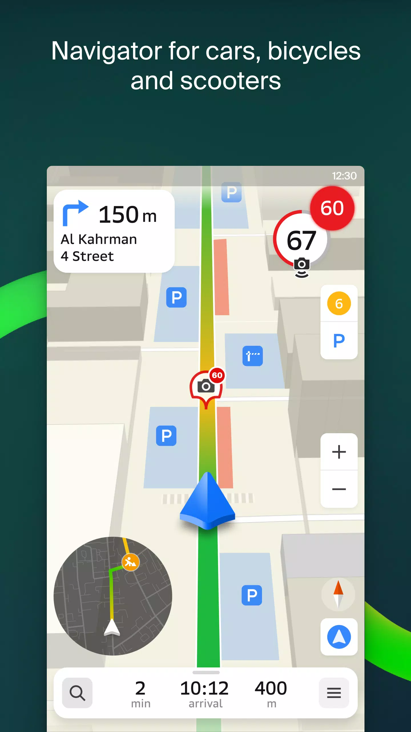
The GPS navigation feature is robust, taking into account real-time traffic conditions, road signs, speed cameras, toll roads, and unpaved routes. It can map out routes between cities and through multiple points. For Android users, there's a free app compatible with Android Auto.
Keep an eye on your loved ones with the live friends' location feature, which allows you to track their GPS location for safety. You can also send fun stickers and check battery levels. Control who can see your location with customizable sharing settings.
Stay informed with real-time road events, including accident reports, blocked streets, and speed camera alerts, all directly displayed on the map.
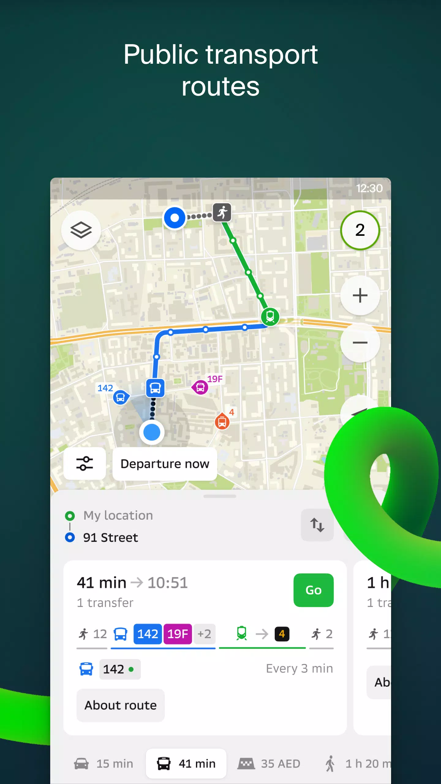
For public transport users, 2GIS provides up-to-date timetables and online route information.
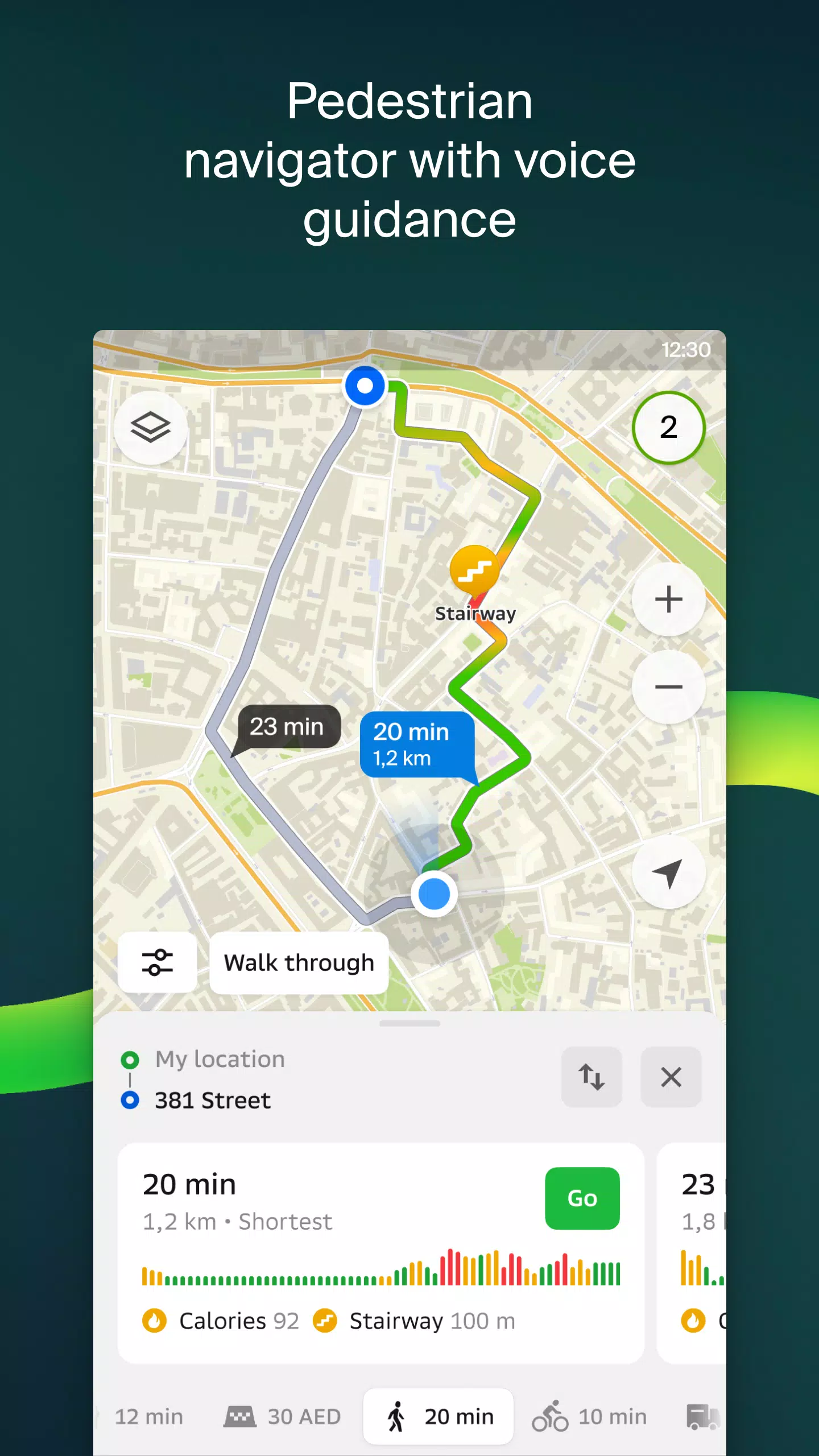
Pedestrian navigation offers seamless walking routes with background operation and voice guidance, ensuring you can navigate on foot effortlessly.
Truck drivers will appreciate the cargo navigator, which tailors routes based on the specific characteristics of their vehicles and cargo.
The detailed directory in 2GIS includes addresses, entrances, postal codes, phone numbers, operating hours, social media links, and websites. Users can also contribute by adding photos and writing reviews of businesses.
Explore cities like a local with 2GIS's travel guide, highlighting major attractions, Wi-Fi hotspots, and other points of interest.
For those with smartwatches running Wear OS, the 2GIS Notifications companion app is a handy tool. It allows you to view maps, receive maneuver hints, and get vibration alerts when approaching turns or destination stops. This app automatically syncs with your phone's navigation and is available for Wear OS 3.0 and later versions.
Available Maps:
Cities of the UAE:
- Dubai, Sharjah, Abu Dhabi, Al Ain, Ajam, Ras Al Khaimah, Fujairah, Umm Al Quwain, Dibba Al Fujairah, Khor Fakkan, Kalba, Al Salamh, etc.
Cities of Russia:
- Moscow, Saint Petersburg, Novosibirsk, Ekaterinburg, Krasnoyarsk, Chelyabinsk, Ufa, Omsk, Kazan, Perm, Nizhny Novgorod, Sheregesh, etc.
Cities of Belarus, Kazakhstan, Uzbekistan, Azerbaijan, and Kyrgyzstan:
- Minsk, Pavlodar, Semey, Aktau, Aktobe, Almaty, Nur-Sultan, Bishkek, Karaganda, Kokshetau, Kostanay, Osh, Baku, Tashkent, etc.
For support, reach out to [email protected].